Showing posts with label waterfront. Show all posts

January 01, 2025

New Year’s Day Ride 2025 + Leslie Lookout

Happy New Year, #BikeTO! Hope 2025 has gotten off to a good start for you. With today being 4’C with some light drizzle in the morning which tapered off later, I went to the 13th Annual New Year’s Day Ride hosted by Alex which started at Yonge & Queen’s Quay. It was my second New Year's Day ride after last year’s one.

January 25, 2024

New Port Lands Bridges Site Check

Yesterday, Waterfront Toronto announced the opening of two new bridges along New Cherry and Commissioners Streets. Some members of the cycling community such as Jun and Brian (video at end of post) have already documented the new bridges, while there has been a lively discussion in the “Cycling in Toronto” Facebook group. Since I had the day off work today, I decided to check out the new bridges as well.

January 01, 2024

New Year's Day 2024 Group Ride

Happy New Year, fellow cyclists! Last year, Jun wrote about a New Year’s Day group ride that Alex put together which involves riding from Queen & Logan to the Tommy Thompson Park lighthouse for a group shot. Since I wanted to step up my bike riding game for 2024, I decided to join this year’s group ride – the 12th time Alex organized this – and check some infrastructure in the Port Lands thanks to Brian Tao.

September 30, 2023

Oshawa to Downtown Toronto

After marking ten years earlier this year, this post marks the 300th on my Two Wheeled Politics blog! 😊 To mark this milestone, I will write about an almost 80 kilometre trip I did on Thursday, September 28 from Oshawa to Downtown Toronto for a day off work.

August 20, 2023

August 2023 Infrastructure Roundup

Over the past few months, I have managed to do a fair number of site checks including along the Eglinton Crosstown and Finch West LRT lines, College, Wellington, and Adelaide. Given the recently completion of the Cabbagetown bikeways and more progress along the Wellington and College routes, I went by these sites this weekend and have a few more updates to pass along.

June 20, 2023

Connecting Southern Ontario's Rail Trails

Over the past few years, I have had the chance to ride several regional trails in southern Ontario; starting with the Greater Niagara Circle Route in 2016. I have since done the Oro Medonte Trail from Barrie to Orillia, the Georgian Trail from Collingwood to Meaford, the Brantford to Port Dover trail, the Elora Cataract, and part of the Omemee Rail Trail near Peterborough. However, a look at Google Maps show there are a lot more regional bike trails, along with some significant gaps. Let’s look at some of these regional trail gaps and how they can be filled.

Map of current bikeways per Google Maps

June 22, 2022

An In Person Consultation for Broadview

Monday marked the first cycling public consultation I got to attend in person since the COVID-19 pandemic began. As much as it can be more convenient to attend the virtual ones – especially when they are far away – the experience helped me appreciate the value of in person sessions. Mainly the ability to ask more detailed questions to city staff, use sticky notes to comment on street roll out plans, and network with staff and other residents. Let’s review what the Broadview Extension environmental assessment has to offer and how the City can build on the plan.

April 27, 2022

Toronto Loop (and a Protected Intersection)

On Sunday, April 24, Albert, Mark, Arthur, and I from the Toronto Community Bikeways Coalition joined urban planner Al Rezoski for a ride covering the Toronto Loop. This recreational loop is 81 kilometres long which consists of the Martin Goodman Trail, Humber River Trail, Finch Hydro Corridor, and the Don River trail system. The loop is one of Mayor John Tory’s long term initiatives which has the potential to encourage cycle tourism in the city. Before starting by Queen’s Park, Al showed us a map of the loop and highlighted the following seven gaps which we planned to stop at for discussion. Some of these gaps will be addressed with the latest bike plan.

  • Stephen Drive (north of The Queensway)
  • Weston Road (between St. Phillips Road and Cardell Avenue)
  • Finch Hydro Corridor (between Weston Road and Norfinch Drive)
  • G Ross Lord Park (near Finch Avenue and Dufferin Street)
  • Yonge Street (at Hendon and Bishop Avenues)
  • Betty Sutherland Trail (between Duncan Mill and York Mills Roads)
  • West Don River Trail (near Eglinton Avenue and Leslie Street)

Toronto Loop highlighted in orange with the seven gaps circled

October 22, 2021

Stepping Up Action on Parkside Drive

Since the Sunnyside Community Association held their meeting in May 2021 and the Safe Parkside Facebook group was created, there was little activity aside from City Council rescinding the afternoon rush hour parking restrictions on Parkside Drive . However, last week’s deaths of Valdemar and Fatima Avila at Parkside and Spring Road – which I use every day to walk Mozzie in High Park – prompted neighbours to organize and renew calls to make Parkside Drive safer for everyone. Lots of “Slow Down” signs were put up along Parkside and 50 to 60 people attended a vigil at the crash site on Tuesday afternoon including Councillor Gord Perks, MPP Bhutila Karpoche, and MP Arif Virani. It’s time to recap some of the upcoming actions, as well as clarify some facts regarding arterial roads.

Members of the Bike Brigade helped marshall the intersection closure during Tuesday's vigil

May 17, 2021

It’s Time for a Safer Parkside

Since the Toronto Community Bikeways Coalition was formed last May, one of their primary asks has been to put in a bikeway along Weston Road and Keele Street from Cardell Avenue to Bloor Street. However, Keele continues onto Parkside Drive from Bloor to Lake Shore Boulevard which is a fast moving arterial and unpleaseant for those who walk or bike. Earlier this month, the Sunnyside Community Association held a Zoom meeting in which many of the more than 40 people in attendance were supportive of safety improvements on Parkside including bike lanes. A separate Facebook group called “Safe Parkside” was also organized around this issue.

A pedestrian crossover is needed at Parkside for this trail immediately north of The Queensway

March 17, 2021

Open Letter on 2021 ActiveTO Proposals

Below is a letter I submitted to the Infrastructure and Environment Committee, Mayor John Tory, and my councillor (Gord Perks) ahead of next Tuesday's committee meeting which will discuss next steps for ActiveTO. The deadline to submit your own comments on Motion IE20.12 (ActiveTO) to iec@toronto.ca (and copy your councillor and Mayor Tory) is Monday, March 22 at 4:30 PM. You can also check out Cycle Toronto's action alert for their own analysis.

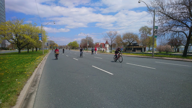
ActiveTO on Lake Shore Boulevard West in May 2020

--

Greetings, Members of the Infratructure and Environment Committee.

Last year was historic for cycling in Toronto with a net 31 kilometres of on-street bike lanes installed that year, as well as the well received major road closures on Lake Shore Boulevard and Bayview Avenue. While I am pleased with the idea of ActiveTO returning this year, I am disappointed that the proposals do not go far enough for several reasons.

February 15, 2021

Winter 2021 Consultation Roundup

While winter may appear to be a slow period for cycling – notwithstanding the growing numbers of people choosing to bike year round – the public consultations have come fast and furious. The City of Toronto hosted two consultations in December bike lanes on Martin Grove Road and Cummer Avenue, while Metrolinx hosted one about the Durham – Scarborough BRT which includes protected bike lanes. In early February, the City unveiled plans to upgrade the Davenport bike lanes and extend them to Yonge. If that wasn’t enough for you, there are at least four more projects the City is currently collecting feedback on.

Rendering of The Esplanade - Via City of Toronto

May 17, 2020

A First Look at ActiveTO

A week following the announcement of CurbTO to address pedestrian hotspots and a City Council meeting that approved measures to look into providing space for people, Toronto finally announced a plan to do so under the ActiveTO banner. ActiveTO aims to create over 50 kilometres of quiet streets, close major roads on weekends, and accelerate the bike plan. The details of the quiet streets and road closures were announced on Thursday, May 14, but nothing was announced for bike lanes yet. Yesterday, Helen and I biked along Lake Shore Boulevard, which closed all eastbound traffic lanes from Windermere Avenue to Stadium Road for the long weekend.

October 10, 2019

Biking Barrie to Orillia

Since moving to the Greater Toronto Area in 2008, the only GO train line that was easily accessible outside of rush hour was the Lakeshore line from Oshawa to Aldershot (just outside of Hamilton). However, GO Transit has expanded service on its Barrie, Kitchener, and Stouffville lines in recent years as part of their Regional Express Rail program. This includes year round weekend service to Barrie in December 2016 and to Niagara Falls since August 2019. Having gotten curious to check out the Oro Medonte Rail Trail, Helen and I brought our bikes on the GO train to Barrie last weekend to try it out.
Barrie's old Allandale train station

July 29, 2019

One Year Later – Where Are We On Protected Intersections?

Last year saw two cyclists killed in places where bike lanes intersected; those being Douglas Crosbie at Dundas and Jones in May and Dalia Chako at Bloor and St. George in June. Those fatalities helped spark new demands for Dutch style protected intersections from road safety advocates and the Toronto Star, while City Council approved ten “complete intersection” pilots. What happened on this file since then?
Cycle Toronto's protected intersection demo at Open Streets TO

November 13, 2017

Not Just Bloor in November

Last week saw Toronto city council vote in favour of making the Bloor bike lanes permanent. While that decision grabbed the bulk of the cycling headlines, several other good developments have happened for Toronto’s cycling community. Let’s find out what they are.

November 08, 2017

Addressing Pickering's Transportation Plan Challenges

For the first time in twenty years, the City of Pickering is updating their Integrated Transportation Master Plan. If there is one thing which badly needs to be addressed in the plan update, it’s their lack of cycling infrastructure. Per this image from Google Maps, Pickering is a cyclist’s black hole except for parts of the Waterfront Trail and a few disconnected bike lanes in the rest of the city; some of which don’t even qualify as bike lanes. Henceforth, I provided this submission to highlight some of the challenges I experienced and suggest some improvements.
Google Maps bicycling layer of Pickering and the rest of Durham Region

August 21, 2017

Summer 2017 Waterfront Roundup

Last year, I wrote up about various quirks along Toronto’s Waterfront. Recently, there have been a lot of new developments which addressed some of these issues, though others remain. Let’s go over ten of these developments going from west to east.

May 17, 2017

A Flooded Commute

Last week, Ontario and Québec were subject to heavy rain and flooding with tourist attractions such as the Toronto Islands closed to the public until at least July. During my bike commute to work this week, I got a close hand encounter of flood conditions by the mouth of the Rouge River.
Submerged access to Toronto-Pickering bridge

March 18, 2017

Get Ajax Moving - Harwood Cycle Tracks

During my interview with Ajax Mayor Steve Parish last fall, he mentioned cycle tracks on Harwood Avenue South were among the town’s most recent installations. Today, I stopped by to get a first-hand encounter of the town’s first cycle track.
Harwood Avenue South at Lake Driveway