This past year has lead to several new cycling adventures north, south, and west of the Toronto area including Sudbury, the Georgian Trail, the Brantford to Port Dover trails, and the Elora Cataract. However, Helen and I hadn’t brought our bikes east yet which was what we did on a rainy Sunday morning when we headed to Peterborough.
We parked our rental car at Jackson Park which is about two kilometres northwest of downtown Peterborough. Once on our bikes and past the parking lot, we came across a pagoda and pond which started our attempt towards Omemee which is 20 kilometres away.Unfortunately, the rain and trail quality prevented us from getting to Omemee and we ended up turning around at Doube’s Trestle Bridge; 13 kilometres from Jackson Park. The Trans Canada Trail – a.k.a. Omemee Rail Trail – is gravel and decent quality from the park to Highway 7 with lots of opportunities to enjoy the fall colours including some wetlands along the way.We went past by some farms including at least one with lots of cows, while Helen spotted a turkey on the way back.The trail quality worsened once we reached the Highway 7 underpass which is very rocky and made sense to walk our bikes through. There were several other poor quality spots between Highway 7 and Orange Corners Road including narrow paths and rocky surfaces which I recommend slowing down if on a road bike. Some parts were also muddy because of the rain, but that was less of an issue east of Highway 7.Despite the trail quality, the views from Doube’s Trestle Bridge were great and worth seeing. A river could be seen below which I was told by a co-worker who rode there earlier had a beaver dam, while a barn was also visible. The bridge has a bench and a bike repair stand on opposing sides.
After we returned to Jackson Park, we continued along the Trans Canada Trail which is paved until it ends at Bethune Street right before downtown. We then headed north along Bethune to get to the Rotary Greenway Trail. Bike lanes would have been appreciated for this gap, but Peterborough makes cycling wayfinding easy with their highway style signage and expected distances.
The Rotary Greenway Trail is paved and goes past Trent University towards Lakefield. We biked past a dam by the river, while I noticed something weird with one of the trail crossings.
In the places where the cycling markings are placed, the curb is no longer flush with the pavement which means people biking have to use the pedestrian zebra stripes. Not an intuitive design, folks!
We turned just before Trent University at Nassau Mills Road and took the path along Water Street towards the Parkway Trail and back to Jackson Park. The Water Street path was fairly narrow and leads into a parking lot at Carnegie Avenue.The Water-Carnegie intersection needs to be better designed to accommodate people who bike, while the narrow sidewalks along Carnegie and Cumberland Avenues for one block each need to be upgraded into proper paths. |
| Note the narrow sidewalks around the apartment building at Cumberland and Carnegie (via Google Maps) |
The Parkway Trail – also paved – is a slight uphill next to Cumberland until it breaks left onto a fully off road path. The off road section is mostly flat until you reach Fairbairn Street just before Jackson Park. That trail crosses the bike lanes on Hillard Avenue which lead to the George and Water Street bike lanes downtown, as well as the Rotary Greenway Trail. A two stage crossing can be found at Chemong Road to make it easier for people who walk or bike to cross.
 |
| Two stage crossing at Chemong Road |
Once at Fairbairn, the trail is a very steep and rocky downhill which we ended up walking down before biking back to the parking lot. We then drove downtown for some dinner – we were very hungry by that point – and to walk around.
George and Water Streets are opposing one ways with the parking placed curbside followed by a buffer and a bike lane. Ideally, the two needed to be switched around to become proper cycle tracks like on Toronto’s Richmond and Adelaide Streets. Even so, we appreciated some of the parking was closed off during COVID-19 to allow for expanded patio and/or walking space.
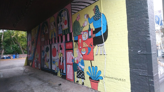
A clock tower at George and Charlotte marks the heart of downtown, while we stopped by Tiny Greens Plant Shop which was a nice spot. We also liked some of the murals put up around downtown.For a city of 81,000 people, Peterborough is not a bad place to bike around. There are several north-south bike lanes such as George, Water, Hillard, and Monaghan, while the trail system offers lots of long distance opportunities. Going west takes you past Omemee towards Lindsay and as far as Uxbridge, while you can go east towards Campbellford and Belleville. From Lindsay, you could go as far north as Halliburton.
 |
| Peterborough could use extending the Lansdowne multi-use trail (bottom) and Hunter bike lanes (top) to complete the cycling grid. (via Google Maps) |


No comments:
Post a Comment