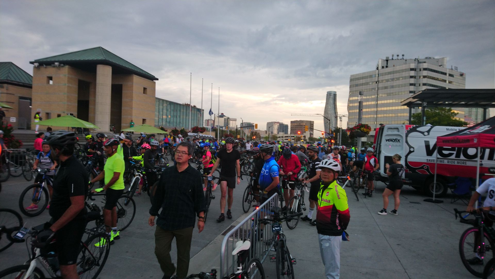
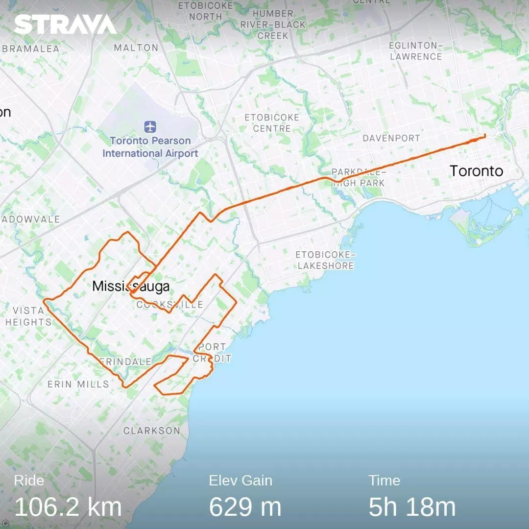
Sunday was a great day for the 15th Annual Tour de Mississauga which saw over 2000 people take part. This family friendly ride has five ride options to choose ranging from 5 km to 100 km, while those doing the 50 km or 100 km had rest stops with complimentary food and drink. I chose the 50 km which – combined with biking to and from Downtown Toronto – lead to my first century ride since the Ride to Conquer Cancer in 2014. The ride offered a good sampling of Mississauga’s trails and bike lanes. Let’s take a look at some of them.
Getting to and from Celebration Square meant taking Bloor Street to just past the Mississauga border where a hydro corridor trail acts as an extension of the Etobicoke Creek Trail to Dundas Street.

I took it north to Burnamthorpe Road which has a multi-use path on the north side all the way to Celebration Square including passing by Square One. There was one pinch point at Little Etobicoke Creek between Dixie and Tomken Roads.
The first road we took was Confederation Parkway which has a painted bike lane all the way from Eglinton Avenue to The Queensway. Given the existence of four traffic lanes and a median, protected bike lanes are better suited here. If Mississauga can put in protected bike lanes on parts of King Street, there is no excuse not to install them on Confederation Parkway.
 |
| A Google Maps screenshot of Confederation Parkway |
The multi-use path on Queensway goes almost to the Toronto border. Where the trail switched from the north to south side at Tedlo Street, many of us simply took the road to Stanfield Road.

Taking Stanfield and Henley Roads past the Applewood Village Plaza brought us to a pedestrian and cycling bridge crossing Queen Elizabeth Way.

We then used a series of quiet streets to get to the Port Credit lighthouse.

Once at Port Credit, we took the Waterfront Trail to Lorne Park Road where the 50 km and 100 km rides first split. Overall, the wayfinding signage was very good.

Lorne Park and Indian Roads both had painted bike lanes – but not all the way across – while the first of two rest stops along the 50 km route was at Vanessa Park. Several porta-potties were there, while volunteers in a tent offered granola bars, bananas, water, lemonade, and strawberry drink. Several bike racks were also put up while riders recharged.

Back on the route, we encountered a problem with the traffic signal at Indian and Mississauga Roads. Despite a critical mass of cyclists waiting to turn left, the traffic signal wouldn’t change without pressing the beg button. Maybe some radar detection can be added here?

Mississauga Road had some construction at the Queen Elizabeth Way which raised cycle tracks could be found.

However, only painted bike lanes were present past the highway interchange despite the 50 km/h speed limit.

These need to be upgraded to protected bike lanes, as well as extended past the University of Toronto Mississauga campus. Another stretch of bike lane returns from Eglinton Avenue to Erin Centre Boulevard before we turned in to Streetsville Memorial Park for the second rest stop.

If there is one bike lane which deserved a failing grade, it’s the one at Bristol Road. With some parts having four traffic lanes plus a centre turning lane, there is more than enough space to upgrade the bike lanes there with protection.

East of Hurontario, the eastbound bike lane is placed in the door zone; something which needs to be phased out and replaced with protected bike lanes placed next to the curb.

A multi-use path (MUP) exists at Kennedy Road and Central Parkway to safely take people under Highway 403. However, it is placed at the east side which prompted many people to ride on the road instead. A fair number of MUP’s in Mississauga are placed on one side only which are not as intuitive as uni-directional cycle tracks. Mississsauga should aim to add MUP’s on the the other side wherever possible to allow for conversion to uni-directional cycle tracks; especially as more residents take up active transportation.
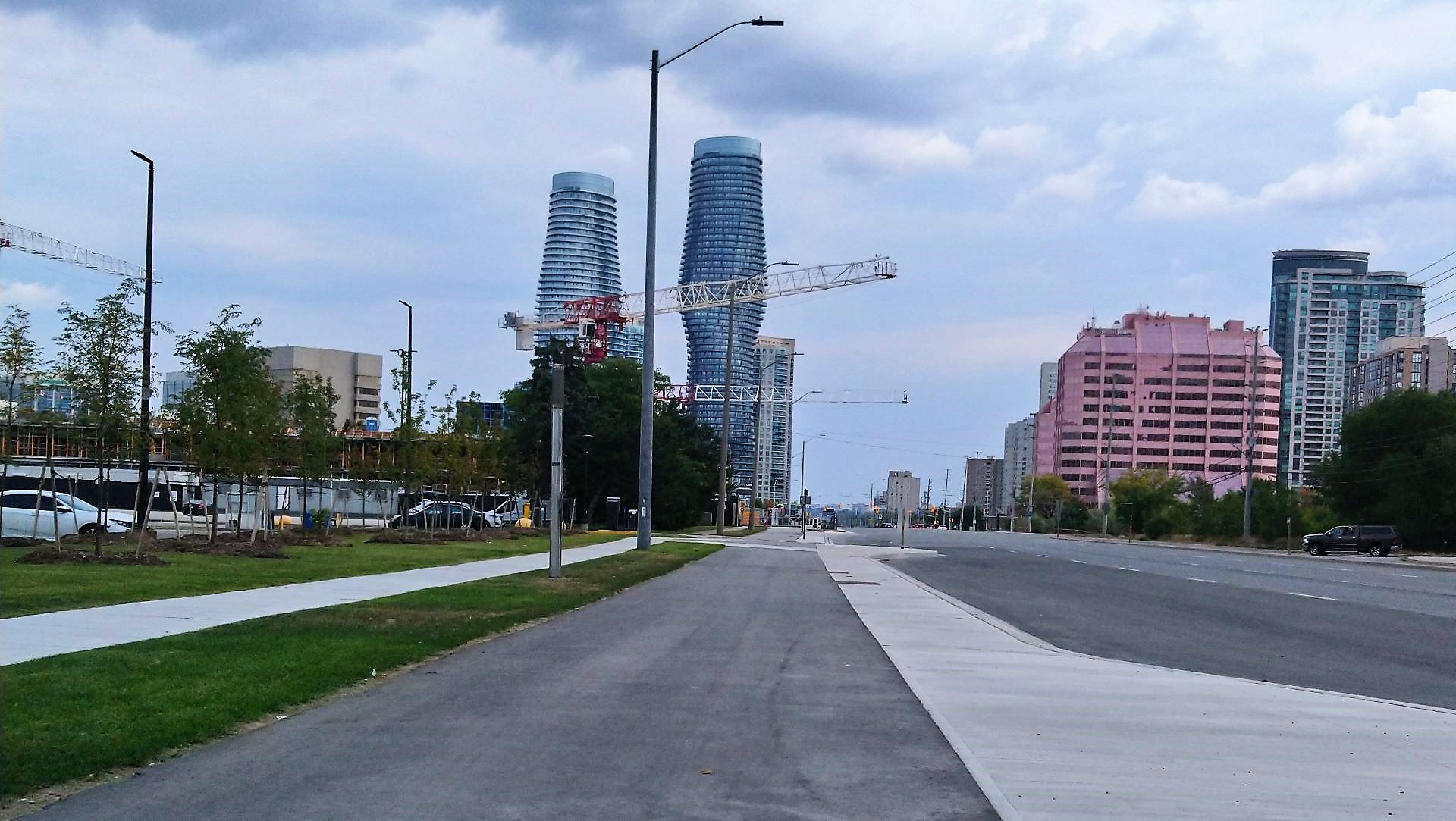
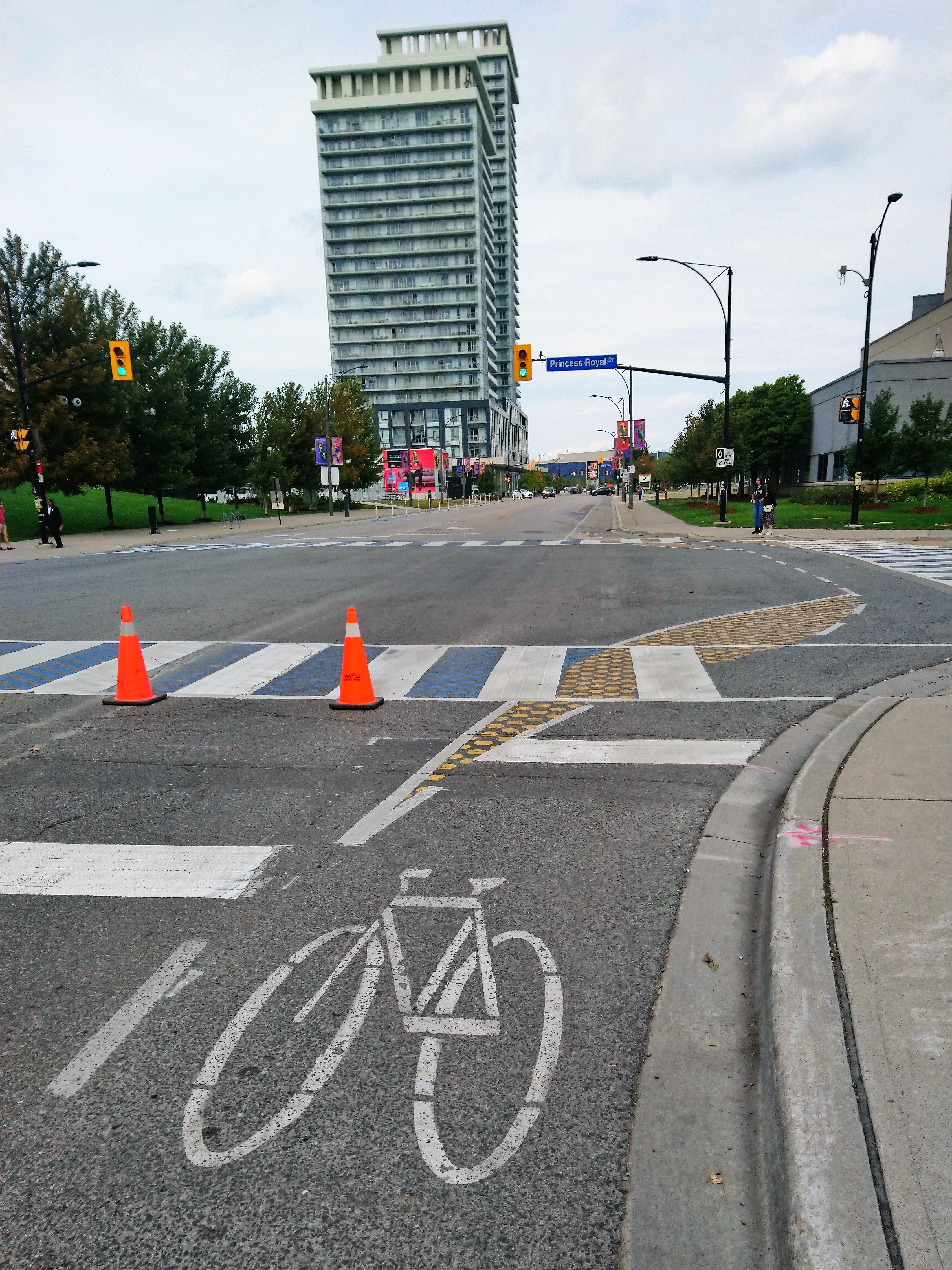
The final stretch of the ride took us along Burnamthorpe, Robert Speck Parkway, and through Square One which is not designed with cycling in mind. However, Mississauga saved the best for last with the protected bike lane at Living Arts Drive and the painted buffers. Painted corner islands were also done at Princess Royal Drive which – if bollards or barriers could be added – could make this a protected intersection.
Once back at Celebration Square, riders got their free ice cream treat and could purchase a meal from one of the food trucks.

Several tents were set up which provided basic bike tuneups from Mississauga Cycles or Velofix, cycling maps and brochures, and t-shirts for sale.

Bike racks were provided while people got to enjoy their ice cream, check out the tents, or relax in the square.

After enjoying my treat and resting my legs, I biked all the way back to Downtown Toronto for a grand total of 106 kilometres.
Thanks to the City of Mississauga and the volunteers for putting together this event. For those who haven’t checked it out, I recommend you add it to your bucket list for 2023.
No comments:
Post a Comment